
Orden de objetos en la ventana de proyecto
Febrero 2017: Sara Pardo le enseña a personalizar el orden de los objetos para lograr una organización más clara y semántica.
May 2014
by Gabriel Funes
Layers in Aimsun help you to structure objects at different heights but they also have other very important properties such as the Visibility field and the Map Mode option.
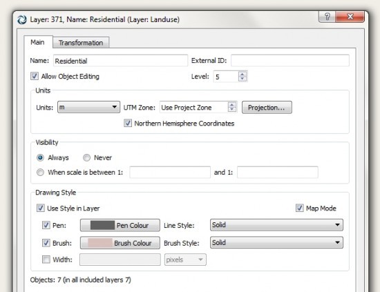
Active layer in Map Mode
By default a layer is always visible (the ‘Visibility: Always’ option is activated) so all of the objects in the layer are always visible and always drawn by Aimsun in view. However, this can cause delays in editing and simulation for large-scale networks. You can significantly improve the Aimsun drawing tool’s performance and speed if you specify what visibility scale you want for each layer.
To take an example, this layer contains buildings and is scaled at 1:35000.
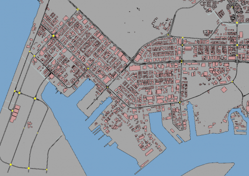
A layer containing buildings
After changing the layer’s Visibility settings to values between 1:1 and 1:15000, the buildings that were previously visible at scale 1:35000 (because they were visible in any scale as the default Visibility setting is Always), are no longer visible (left-hand image below). In order to see them, you need to lower the scale to a value of less than 1:15000, for example 1:10000 (as in the right-hand image).
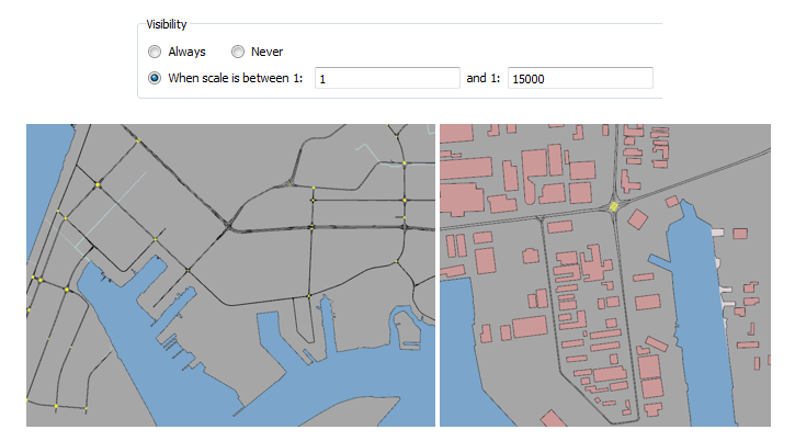
Scale 1:35,000 (left); scale 1:10,000 (right)
When a layer is active in Map Mode, the objects belonging to this layer have various functionalities when you are drawing.
1. Drawing objects
You can draw objects using the ‘Drawing Style’ in each layer. If no drawing style is active, then you can colour each object individually. You can draw sections according to their the functional class. The functional class depends on the road type and each one has its own size and colour.
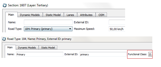
Section and road type
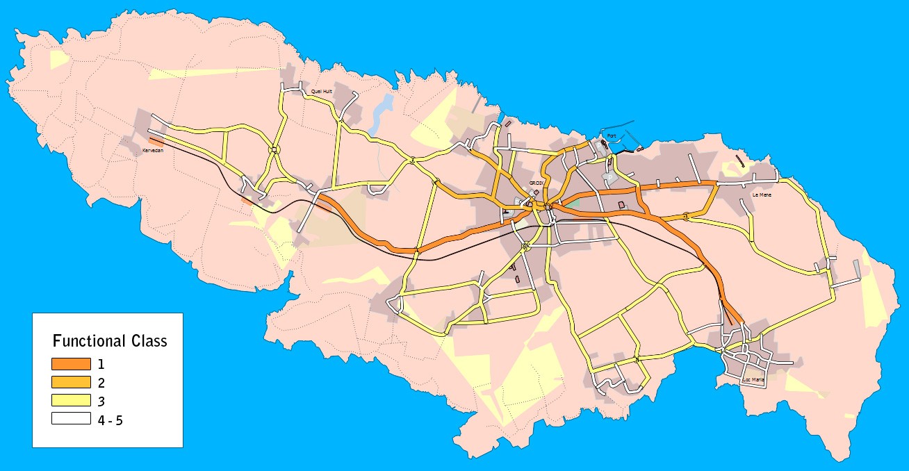
Functional class
2. Filtering objects
In addition to drawing, you can filter the objects you want to draw depending on the zoom level. This allows you to optimise the object that you are going to load into the view and make the tool smoother and easier to use.
To illustrate: you wouldn’t draw the entire road network of a whole country in full zoom; you would zoom out.
The objects differ according to type:

The city of Bangkok viewed at three zoom levels: the greater the zoom, the greater the detail and number of objects.

Febrero 2017: Sara Pardo le enseña a personalizar el orden de los objetos para lograr una organización más clara y semántica.

Dimitris Triantafyllos explica cómo utilizar la estructura de carpetas del proyecto Aimsun Next para gestionar automáticamente los archivos del modelo.
SHARE
Aimsun Next 23
Aimsun Next 20.0.5
Aimsun Next 23
@manual {AimsunManual,
título = {Aimsun Next 23 User’s Manual},
autor = {Aimsun},
edición = {Aimsun Next 23.0.0},
domicilio = {Barcelona, Spain},
año = {2023. [Online]},
mes = {Accessed on: Month, Day, Year},
url = {https://docs.aimsun.com/next/23.0.0/},
}
Aimsun Next 20.0.5
@manual {AimsunManual,
título = {Aimsun Next 20.0.5 User’s Manual},
autor = {Aimsun},
edición = {Aimsun Next 20.0.5},
domicilio = {Barcelona, Spain},
año = {2021. [En software]},
mes = {Accessed on: Month, Day, Year},
url = {qthelp://aimsun.com.aimsun.20.0/doc/UsersManual/Intro.html},
}
Aimsun Next 23
TY – COMP
T1 – Manual del usuario de Aimsun Next 23
A1 – Aimsun
ET – Aimsun Next Version 23.0.0
Y1 – 2023
Y2 – Acceso: Mes, Día, Año
CY – Barcelona, España
PB – Aimsun
UR – [En software]. Disponible en: https://docs.aimsun.com/next/23.0.0/
Aimsun Next 20.0.5
TY – COMP
T1 – Manual del usuario de Aimsun Next 20.0.5
A1 – Aimsun
ET – Aimsun Next Version 20.0.5
Y1 – 2021
Y2 – Acceso: Mes, Día, Año
CY – Barcelona, España
PB – Aimsun
UR – [In software]. Available: qthelp://aimsun.com.aimsun.20.0/doc/UsersManual/Intro.html